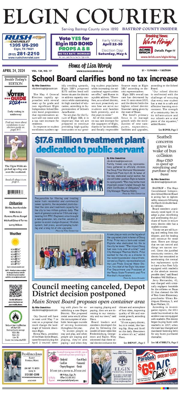
.png)


DENTON — New flood maps have been finalized and will become effective on May 9, 2023, for Bastrop County.
During the next six months, a Federal Emergency Management Agency compliance specialist will work with the community to update each floodplain ordinance and adopt these new flood maps. Residents are encouraged to examine the maps to determine if they are in a low-to-moderate or high-risk flood zone.
By understanding flood risks, individuals can decide which insurance option is best for their situation. Community leaders can use these maps to make informed decisions about building standards and development that will make the community more resilient and lessen the impacts of a flooding event.
PLEASE LOG IN FOR PREMIUM CONTENT. Our website requires visitors to log in to view the best local news.
Not yet a subscriber? Subscribe today!